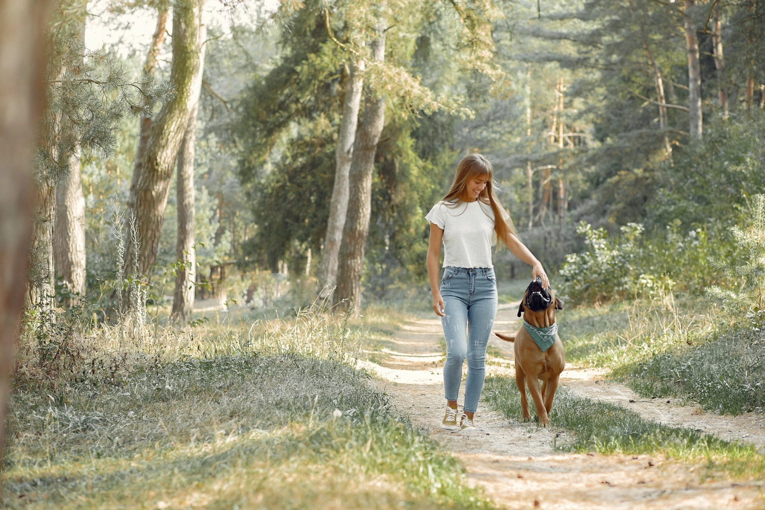
The Kent Downs section of the North Downs Way is some of the finest dog walking in southern England. Chalk ridgelines, panoramic views across the Weald, quiet villages, and a mix of open downland and ancient woodland — all within an hour of Folkestone, Hythe or Dover. This guide covers the best walkable sections through the Kent Downs National Landscape, with the practical detail that matters when you're actually there with a dog: where to park, where signal drops out, where livestock grazing means leads are non-negotiable, and which stretches suit which type of walk.
For the full picture of dog walking across the county — Romney Marsh, coastal paths, woodland walks and more — see our complete guide to dog walks in Kent.
Important: Livestock law changed on 18 March 2026
The Dogs (Protection of Livestock) (Amendment) Act 2025 came into force on 18 March 2026. Fines for livestock worrying are now unlimited (previously capped at £1,000), and the definition of livestock worrying has been broadened to include chasing and being at large among livestock without control.1 Read our complete Kent dog safety guide for the full details of what changed.
Jump to a section
- What is the Kent Downs Way?
- Wye Circular via Devil's Kneading Trough
- Charing to Wye
- Wye to Etchinghill
- Folkestone to Dover (Two Harbours Walk)
- Terrain and difficulty
- Livestock on the Kent Downs
- Mobile signal on the Kent Downs Way
- Seasonal notes
- Car parks and getting there
- Nearest dog groomers after your walk
What Is the Kent Downs Way?
The North Downs Way is a 153-mile National Trail running from Farnham in Surrey to Dover in Kent, following the chalk ridge of the North Downs.2 The trail was officially opened in 1978 — the opening ceremony took place at the Wye Crown, on the stretch of the trail that overlooks the Kent Downs.3
The Kent portion of the trail — roughly from Wye eastwards to Dover — passes through the Kent Downs National Landscape (renamed from Area of Outstanding Natural Beauty on 22 November 2023).4 This is the stretch this guide focuses on. It is the most dramatic section of the entire trail: chalk downland with views across the Weald to the south, then dramatic cliff-top paths as the trail reaches the coast above Folkestone and follows the White Cliffs to Dover.
Dogs are welcome on the North Downs Way.5 The trail is not fenced or gated throughout, and there are no access restrictions for dogs beyond the standard Countryside Code requirements for leads around livestock and on Open Access land during bird nesting season (1 March to 31 July).6
You do not need to walk all 153 miles. The trail works as a series of day-walk sections, and the Kent stretches can be combined with bus or train routes back to your start. The Kent Downs National Landscape website and Explore Kent both publish downloadable route guides for individual sections.7
Walk 1: Wye Circular via Devil's Kneading Trough
| Distance | Approximately 4 miles (6.4 km) circular |
| Difficulty | Moderate — one steep climb at the end |
| Start/Finish | Wye village (TN25 5AN) |
| Parking | Small free car park on Occupation Road, Wye; or street parking in the village |
| Train | Wye station (Southeastern, Ashford International to Canterbury West line) |
| Livestock | Yes — grazing cattle and sheep on Wye Downs. Lead required. |
This is the most popular short walk on the Kent section of the North Downs Way, and for good reason. The route climbs from Wye village up onto the Downs, passes the Wye Crown (a crown shape cut into the chalk hillside, visible for miles), and reaches the Devil's Kneading Trough — a steep dry valley cutting into the Downs that is one of the most dramatic natural features in Kent.
The Kneading Trough sits within the Wye National Nature Reserve, a 134-hectare site of chalk grassland managed by Natural England. The reserve has 21 recorded species of orchid and is one of the most botanically rich sites in southern England.8
Dog owners should note: Conservation grazing is used to manage the chalk grassland on Wye Downs. Cattle and sheep graze on the open downland throughout the year. Your dog must be on a lead through the nature reserve. This is not optional — it is both a conservation requirement and a legal obligation under the Countryside Code on Open Access land.6
The walk is circular, which makes it practical with a car. The steep section comes at the end as you climb back up to the ridge from the valley floor. Most dogs handle this without difficulty, but it is genuinely steep — if your dog has joint issues or limited mobility, consider one of the flatter sections below.
Wye village has a pub — the Tickled Trout — and a café, both accessible from the walk route if you want a stop before or after.
Walk 2: Charing to Wye
| Distance | 7 miles (11.3 km) linear |
| Difficulty | Easy to moderate — rolling terrain, no severe climbs |
| Start | Charing village (TN27 0HU) |
| Finish | Wye village (TN25 5AN) |
| Parking | Charing village car park or street parking; return by train from Wye to Charing (same line) |
| Train | Charing station to start; Wye station at the end (both on the Ashford to London line) |
| Livestock | Possible in farmland sections — keep your dog under control |
This is a gentler section of the North Downs Way — rolling farmland, orchards, patches of woodland and views across the Weald without the steep climbs of the ridge-top sections. The path climbs out of Charing (a quiet village with the remains of an Archbishop's Palace) and passes through open countryside, past Eastwell Park and the small village of Boughton Lees, before dropping into Wye.3
This is a linear walk, so you need to arrange transport back to Charing or walk back. The simplest option is to take the train: both Charing and Wye are on the Southeastern Ashford to London line, and the journey between them takes roughly 8 minutes. Dogs travel free on Southeastern trains.
This section is a good choice for dogs that overheat on exposed paths — there is more tree cover and shelter than the ridge-top sections, with less sustained uphill.
Walk 3: Wye to Etchinghill
| Distance | 11.25 miles (18.1 km) linear |
| Difficulty | Moderate to hard — sustained ridge walking with climbs |
| Start | Wye village (TN25 5AN) |
| Finish | Etchinghill (CT18 8BX) |
| Parking | Wye village car park or Wye station; limited parking at Etchinghill near the village hall |
| Livestock | Yes — conservation grazing on Wye Downs and around Stowting. Lead required when livestock visible. |
This is the signature section of the Kent Downs Way — the stretch where the trail was first opened in 1978 and arguably the finest ridge walk in south-east England. The route climbs from Wye past the Crown and Devil's Kneading Trough, then stays near the top of the Downs for most of the way, passing through open downland with enormous views. On a clear day you can see the coast from the ridge, a reminder that the end of the trail at Dover is not far ahead.3
The path passes near the village of Stowting (roughly halfway) and continues along the scarp to Etchinghill. There is a pub in Stowting — the Tiger Inn — which is dog-friendly and makes a good halfway stop if you need water and a rest.
This is a full day walk. At 11.25 miles and with significant elevation gain, this is not a casual afternoon stroll. Make sure your dog is conditioned for a walk of this length, carry enough water for both of you, and in summer start early to avoid the midday heat on the exposed ridge.
The return journey is more complicated than Charing–Wye because Etchinghill does not have a railway station. Options: arrange a car at both ends, take a taxi from Etchinghill back to Wye, or catch a bus from Etchinghill to Folkestone (Stagecoach route 17) and then train from Folkestone to Wye.
Walk 4: Folkestone to Dover (Two Harbours Walk)
| Distance | 9 miles (14.5 km) linear |
| Difficulty | Moderate — undulating cliff-top path with some steep sections |
| Start | Folkestone Harbour (CT20 1QH) |
| Finish | Dover seafront (CT16 1HJ) |
| Parking | Folkestone Harbour pay-and-display; return by train from Dover Priory to Folkestone Central |
| Train | Folkestone Central to start; Dover Priory at the end (Southeastern, roughly 12 minutes between stations) |
| Livestock | Highland cattle sometimes graze in the Warren; cattle and sheep on White Cliffs cliff-top grassland |
The Two Harbours Walk is the final section of the North Downs Way before it reaches Dover, and it is one of the most dramatic stretches of the entire 153-mile trail. The path runs along the cliff tops from Folkestone Harbour, through East Cliff and Warren Country Park, and along the Heritage Coast to Dover's Western Heights and down to the seafront.9
This is the walk to do on a clear day. You look straight across the Channel — France is 21 miles away and visible on most days. The Warren section covers roughly 5 miles of coastline between Folkestone and Dover and is one of the most important geological and wildlife sites in southern Britain. Dogs are welcome on the Warren beach year-round with no seasonal restrictions.10
Safety note: The chalk cliffs are actively eroding. Keep your dog under close control and well away from cliff edges — there are sheer drops with no barriers in places. Highland cattle are sometimes used for conservation grazing in the Warren, and cattle and sheep graze on the White Cliffs cliff-top grassland managed by the National Trust. Keep your dog on a lead whenever livestock are present.
The return by train from Dover Priory to Folkestone Central takes roughly 12 minutes on Southeastern services. Dogs travel free. This makes the linear walk very practical for dog owners with a car parked at Folkestone.
Terrain and Difficulty
The North Downs Way through the Kent Downs is chalk downland walking. This means:
- Underfoot: Chalk paths, grass tracks and some woodland sections. After rain, chalk becomes slippery — good boots are essential, not trainers. Paws get chalky but not muddy in the way clay does.
- Stiles: Some sections have stiles rather than gates. If your dog cannot climb or be lifted over a stile, check the specific route before you go. The Explore Kent website notes stile locations on their downloadable guides.7
- Exposed ridge: The ridge-top sections (Wye to Etchinghill, Folkestone to Dover) are fully exposed to wind and sun. No shade on long stretches. Carry water for your dog.
- Elevation: The Downs rise to around 180–190 metres above sea level. The climbs from the valleys are steep but short. Dogs in reasonable fitness handle them well.
Which walk suits which dog?
- Older dogs or limited mobility: Charing to Wye (gentlest terrain, most shelter)
- Active dogs, full day out: Wye to Etchinghill (longest, most rewarding ridge walk)
- Short walk with a big view: Wye Circular (4 miles, steep finish but manageable)
- Coastal drama and easy train return: Folkestone to Dover (9 miles, cliff-top walking)
Livestock on the Kent Downs
Livestock on This Route
Conservation grazing is used extensively across the Kent Downs to manage the chalk grassland. Cattle and sheep graze on Wye Downs, on the White Cliffs cliff-top grassland, and in fields adjacent to the trail between Stowting and Etchinghill. Highland cattle are sometimes used in the Warren between Folkestone and Dover. Dogs must be on a lead whenever livestock are present. Under the new livestock worrying law (in force since 18 March 2026), even chasing livestock from a distance can result in unlimited fines.1 Read the full guide to dog safety in Kent for more details.
The Countryside Code requires dogs on leads around livestock on Open Access land at all times, and between 1 March and 31 July on all Open Access land regardless of whether livestock are present (to protect ground-nesting birds).6
If cattle or horses chase you and your dog, let the dog go. Your dog can outrun them; you cannot.
Mobile Signal on the Kent Downs Way
Mobile Signal on This Route
Signal can drop out in the valleys between Wye and Hastingleigh, in the wooded sections near Stowting, and at the base of the cliffs in the Warren between Folkestone and Dover. On the ridge itself, coverage is generally reasonable, but do not rely on it in the dips. If your dog is a bolter and you walk in these areas regularly, a GPS tracker designed for rural Kent use is worth considering — it works independently of your phone signal.
The Folkestone to Dover section has the best signal overall, as the path stays close to the coast and within range of established masts. The weakest coverage is on the Wye to Etchinghill section in the valley dips.
Seasonal Notes
- Spring (March–May): Wildflowers on the chalk grassland, including orchids from late April. 1 March to 31 July: dogs on lead on Open Access land (ground-nesting bird season). Lambing season — extra caution around sheep fields.
- Summer (June–August): Exposed ridge sections are hot with no shade. Walk early morning or after 4pm. Carry water for your dog. Ticks are active in grass and scrub — check your dog after every walk. Our Kent dog safety guide covers tick prevention in detail.
- Autumn (September–November): The best time for these walks. Cooler temperatures, fewer livestock, and the beech woodland along the trail turns gold and copper. Clear autumn days give the biggest views.
- Winter (December–February): Chalk paths can be slippery after frost. The ridge is exposed to wind and rain — be prepared for proper cold. Short daylight hours mean early starts for longer sections. The Charing to Wye section works well in winter thanks to woodland shelter.
Car Parks and Getting There
| Location | Parking | Postcode | Notes |
|---|---|---|---|
| Charing | Village car park and street parking | TN27 0HU | Free parking; village has shops |
| Wye | Small car park on Occupation Road; street parking | TN25 5AN | Fills up on sunny weekends — arrive early |
| Etchinghill | Limited verge/village parking | CT18 8BX | No dedicated car park; park considerately |
| Folkestone Harbour | Pay-and-display car park | CT20 1QH | Good for Two Harbours Walk start |
| White Cliffs (Dover) | National Trust car park (charges for non-members) | CT16 1HJ | Fills up on sunny weekends — arrive before 10am in summer |
Getting there by train: The Kent sections of the North Downs Way are well served by Southeastern rail services. Charing, Wye, Folkestone Central and Dover Priory are all on the network. Dogs travel free on Southeastern trains and do not require a ticket.
Nearest Dog Groomers After Your Walk
Nearest Groomer After Your Walk
After a chalky downs walk, your dog may need a wash. Find a groomer in Folkestone, Hythe or Dover for a post-walk clean-up. Our guide to finding a good groomer in Kent explains what to look for.
Where to Go Next
Related guides
Sources and References
Legislation
- Dogs (Protection of Livestock) (Amendment) Act 2025 — In force 18 March 2026. Unlimited fines, broader livestock worrying definition, stronger police powers.
Trail and Landscape
- North Downs Way — 153-mile National Trail from Farnham to Dover.
- North Downs Way route description — Section distances, terrain notes, and Wye Crown opening in 1978.
- Kent Downs — renamed to National Landscape — All AONBs in England and Wales renamed National Landscapes on 22 November 2023.
- North Downs Way — dogs welcome — Confirmed dog-friendly on the official trail guide.
- The Countryside Code — dog walking rules — Dogs on lead around livestock on Open Access land; dogs on lead 1 March–31 July on Open Access land regardless of livestock.
- Kent Downs National Landscape and Explore Kent — Downloadable route guides for Kent walking trails.
- Wye National Nature Reserve — 134 hectares of chalk grassland managed by Natural England, 21 recorded orchid species.
Specific Locations
- Folkestone to Dover walk (Two Harbours Walk) — 9-mile (14.5 km) coastal route via East Cliff and Warren Country Park.
- Folkestone & Hythe District Council — Dogs on beaches — No seasonal restrictions on The Warren beach.
Disclaimer: All facts, distances, access rules and contact details are accurate as cited from the sources above. Access rules, seasonal restrictions and opening times can change — always verify current details via the official links provided before visiting. This guide provides information for Kent dog owners and does not constitute legal advice.
Move from research into real local options
Use the directory to compare live grooming listings, or check the Kent price guide first if you want a quick cost sense-check before contacting a business.